The Geography of Lisbon
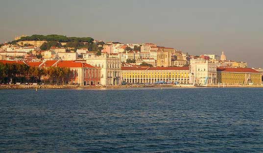
Lisbon, capital city, is located on the right side of the Tagus river in the center of Portugal. Portugal is located in south-western Europe, bordered by Spain on the north and east and by the Atlantic Ocean on the south and west. It is the westernmost city in continental Europe and lies more or less in the centre of the country, approximately 300 km from the Algarve in the south and 400 km from the northern border with Spain.
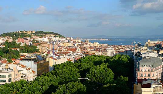
It has an area of 84 sq. km. and a population of 556 797 inhabitants. The area known as Greater Lisbon has a population of 2,1 million in an area of 2750 sq. km.
It has an area of 84 km2, 53 civil parishes and a population of almost 550 thousand inhabitants, thus being the most populous city in the country, followed by Porto. The area known as Greater Lisbon (which includes Lisbon and the surrounding areas) concentrates a population density of 3 million inhabitants spread over 2750 km2.
Lisbon is connected to the south bank by Ponte 25 de Abril (25th of April Bridge), inaugurated in 1966 between Lisbon and Almada, and by Vasco da Gama Bridge (inaugurated in 1998 to connect Lisbon to Alcochete and Montijo). To the north is the district of Leiria, and northeast and east is Santarém. The Atlantic Ocean and the Tagus estuary are to the south, which also demarcates Lisbon to the east, separating it from the district of Setúbal.
Tagus River, the largest in the Iberian Peninsula, is born in the Albarracín mountain, Spain, at 1593 meters altitude and flows into the Atlantic Ocean, in Lisbon, after covering just over 1000 kilometres.
And it was precisely from the mouth of the Tagus River that the Portuguese sailed, in vessels and caravels, to discover the world.
Due to its privileged geographical location, every year, the Port of Lisbon receives hundreds of luxury passenger ships. This city also has a Natural Reserve of the Tagus estuary, where many bird species nest.